
There is a wide variety of hiking trails in Tenerife, so if you want to connect with nature and enjoy outdoor walks, here you will find itineraries for all tastes.
During our trip around Tenerife we had the opportunity to explore some of the most renowned trails and I can assure you that each one has its own charm: from lush laurisilva forests and majestic ravines to dreamy beaches and landscapes that seem straight out of a science fiction movie. That’s why hiking in Tenerife is one of the best activities you can do on this Canary Island.
In this guide, I will present the most outstanding hiking trails in Tenerife and provide you with all the necessary information to enjoy them to the fullest.
I also invite you to take a look at our guide on what to see in Tenerife, where you will find other activities and the main tourist attractions.
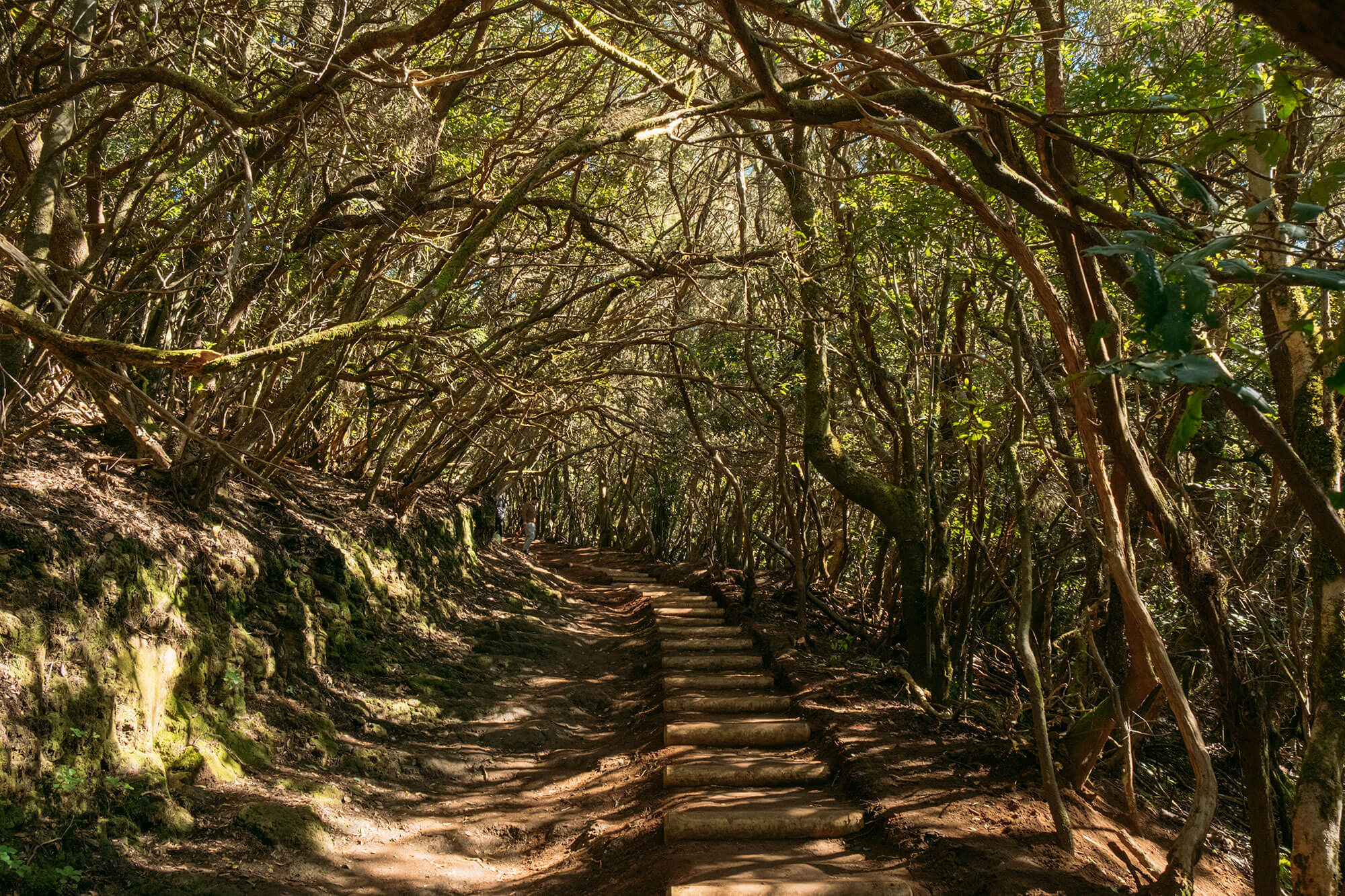
1. Trail of the Senses: A multisensory experience in Anaga
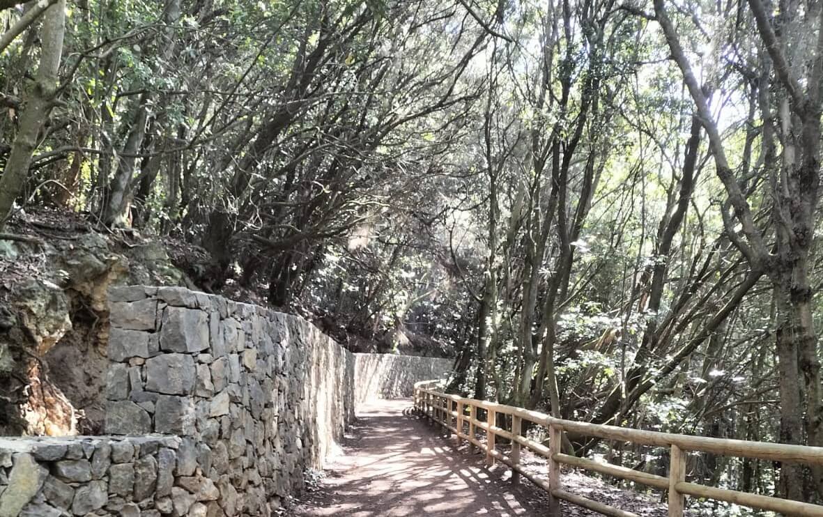
The Trail of the Senses is one of the most famous routes in Tenerife, located in the Anaga Rural Park. Its name comes from the sensory experience it offers, as following the instructions on the various panels allows you to discover Anaga through sight, hearing, smell, and touch.
This route is composed of three interconnected trails. If you have little time or are looking for an easy walk, Trail 1 is ideal, as it follows a walkway with minimal incline up to the Cruz del Carmen viewpoint. Moreover, it is suitable for people with reduced mobility or those in wheelchairs. Trail 2, on the other hand, follows a dirt path perfect for exploring the laurisilva forest. Finally, Trail 3, the longest, is the perfect option for those who have more time and want to venture further into the laurisilva until reaching the Llano de los Loros viewpoint.
The three trails start from Cruz del Carmen, where the parking lot is located, and pass by the namesake viewpoint. Since they are interconnected, those who choose Trail 3 will simultaneously cover Trails 1 and 2. Check this map for more details on this circular trail in Tenerife.
Trail 1
Duration: 10 minutes
Distance: 340 meters
Difficulty: Very low
When to do it: any time of year
Type: round trip
Obstacles: none
Elevation gain: 6 meters
Trail 2
Duration: 15 minutes
Distance: 540 meters
Difficulty: Low
When to do it: any time of year
Type: circular
Obstacles: dirt path
Elevation gain: 20 meters
Trail 3
Duration: 30 minutes
Distance: 1.27 km
Difficulty: Low
When to do it: any time of year
Type: circular
Obstacles: dirt path
Elevation gain: 100 meters
[DOWNLOAD ROUTE]
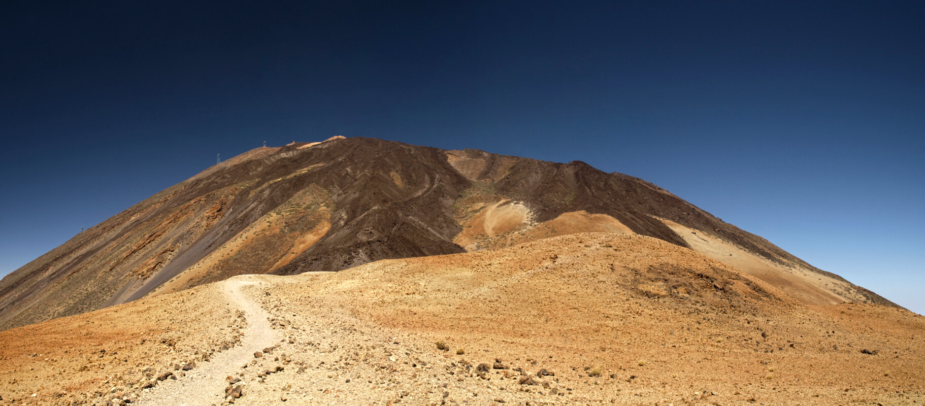
2. Montaña Blanca: Epic ascent to Teide
Trail 7, also known as Montaña Blanca, stands out as one of the must-do routes to ascend Teide.
This hike begins at the base of Montaña Blanca and ascends to La Rambleta, located at 3555 meters above sea level, which is the highest point accessible on Teide without a permit. With a length of about 8 kilometers and a significant elevation gain, this route requires good physical condition or mountaineering experience, although the views and the volcanic landscape—which seem from another dimension—make it totally recommendable.
In addition to Trail 7 or Montaña Blanca, you can reach La Rambleta via the TF 38 route, which passes through Pico Viejo, the second highest peak on the island, although this option is longer and more demanding.
Once at La Rambleta, I suggest taking Trail 10 or Telesforo Bravo, which leads to the summit of Teide (access subject to permit, which you can request here). Alternatively, if you do not have the permit, there is Trail 11, which reaches the Fortaleza Viewpoint, or Trail 12, which leads to the Pico Viejo Viewpoint, considered one of the best viewpoints of Teide.
You can also choose to book a full-day excursion to ascend Teide, which includes the necessary permit to reach the summit.
Duration: 5–6 hours of ascent
Distance: 8.3 km
Difficulty: High
When to do it: spring and autumn months
Type: out-and-back
Obstacles: steep elevation gain
Elevation gain: 1362 meters
[DOWNLOAD ROUTE]
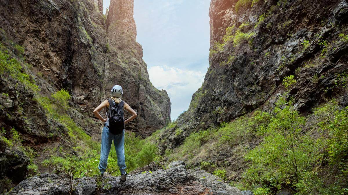
3. Masca Gorge: Challenging trekking between mountains and sea
Masca Gorge is perfect for travelers who want to enjoy a trek in Tenerife. This route has been closed for over 3 years and, currently, access is only allowed on Saturdays, Sundays, and holidays. In addition, there is a daily limit of 125 people in winter and 150 in summer, organized in groups of 25 every half hour. It is essential to have a permit, which can be requested at this website.
The hike starts at the Masca Hamlet, a remote village nestled among mountains. The highlights of this route are the thrilling descent through Masca Gorge, which ends at the eponymous beach, and the subsequent ascent up the same slope.
When we did this route, there was a boat ramp at Masca beach connecting with Los Gigantes; however, it is currently not operational, which forces you to complete the journey on foot, making it one of the most demanding routes in Tenerife.
If you dare to take on this route, which is part of the network of hiking trails in Tenerife, I recommend checking our guide on the Masca Gorge, where you will find details about permits, schedules, requirements, and other useful information.
You can also opt to book a guided tour to avoid worrying about permit management.
Duration: descent in 3 hours and ascent in 4 hours
Distance: 5 km one way (10 km round trip)
Difficulty: descent of medium difficulty and ascent of high difficulty
When to do it: spring and autumn months
Type: out-and-back
Obstacles: elevation gain on the ascent and slippery terrain
Elevation gain: 750 meters
[DOWNLOAD ROUTE]
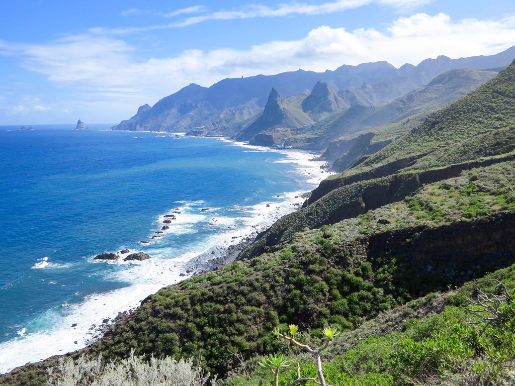
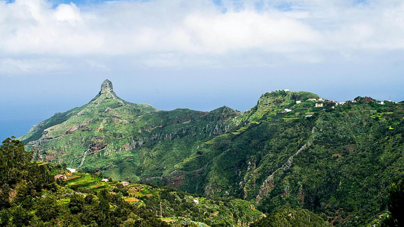
4. Afur – Taganana: Discover Anaga on an unforgettable circular route
In Anaga, trails abound, but the itinerary that connects Afur and Taganana has earned a special place among the circular routes of Tenerife, allowing you to discover laurisilva forests and traverse impressive cliffs.
The route starts in Afur, a small and picturesque mountain village with fewer than 100 inhabitants, from where the trail begins that ventures into the Anaga massif towards Taganana, a town rich in history and architecture.
Among the highlights of this journey is Tamadite Beach, considered one of the best beaches in Tenerife due to the surrounding cliffs that frame it and give it a unique landscape. Note that swimming is not allowed at this beach due to strong currents. Another attraction is the Roques de Anaga viewpoint, from which you can admire the cliffs and the Atlantic Ocean.
Undoubtedly, it is one of the most complete trails in Tenerife, as it combines typical natural landscapes of the island with a visit to two of its most emblematic towns: Afur and Taganana.
Duration: 5–6 hours
Distance: 12 km
Difficulty: Medium
When to do it: any time of year
Type: circular
Obstacles: ascent and descent of the ravine leading to Tamadite Beach
Elevation gain: 690 meters
[DOWNLOAD ROUTE]
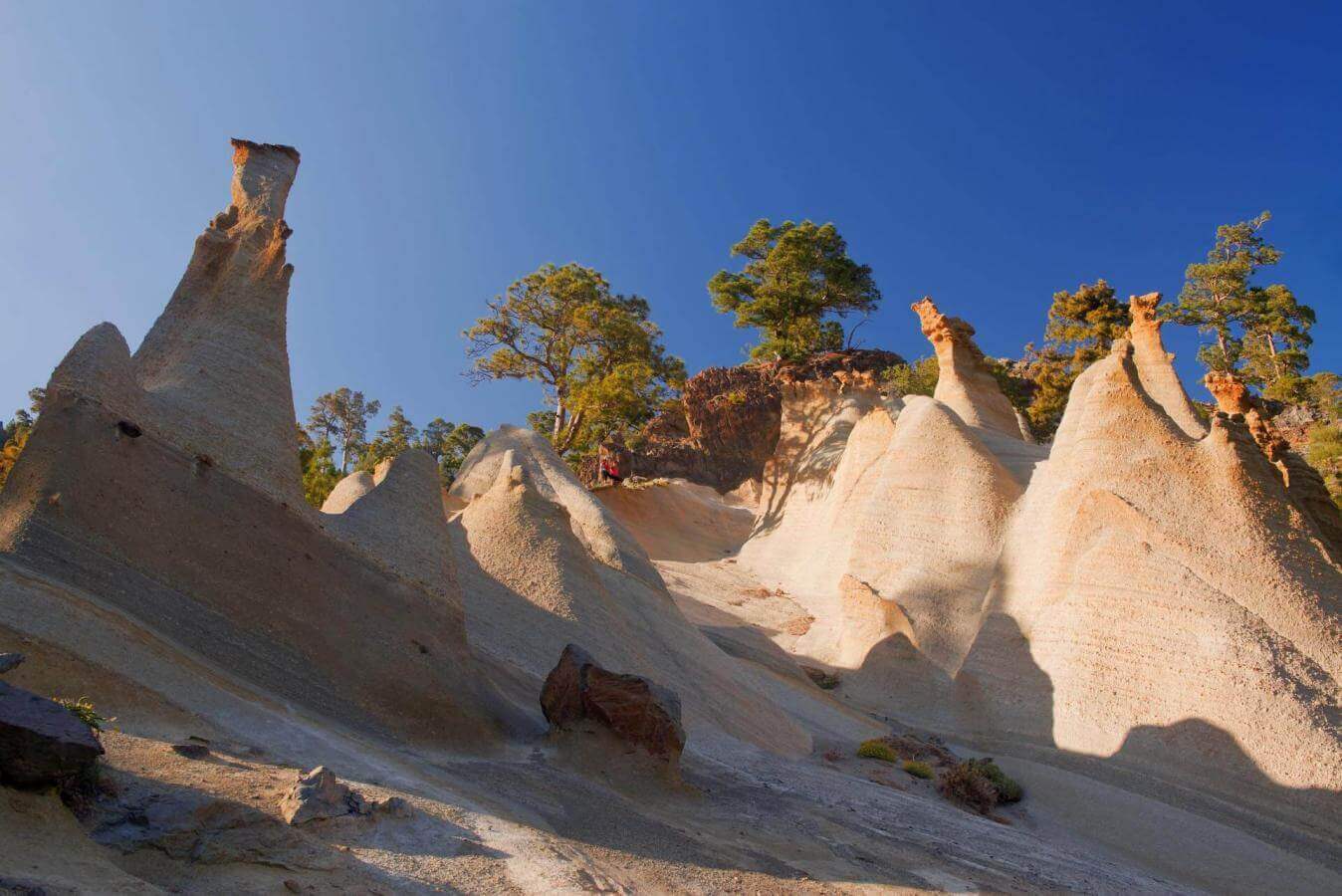
5. Vilaflor and the Lunar Landscape: A journey through the south of Tenerife
From the town of Vilaflor begins one of the most spectacular routes, that of the Lunar Landscape.
This trail, one of the oldest in Tenerife, is part of the Camino Real de Chasna, used by the Guanches 500 years ago to travel from the north to the south of the island. Although today the objective is not to cross the island, the circular itinerary that traverses the Lunar Landscape offers a unique experience.
In addition to strolling through a Canary pine forest, this route in the south of Tenerife leads you to one of the most astonishing settings: the Lunar Landscape. It is an area where you can observe numerous beige-toned rock formations, sculpted by erosion into unusual shapes, almost as if designed by a modernist artist. You will feel as if you have traveled to the Moon.
The route is very well marked; you just need to follow the direction to Los Escurriales, the area where this peculiar lunar landscape is concentrated.
It is undoubtedly one of the best walks in the south of Tenerife, ideal for enjoying a peaceful environment.
Duration: 4 hours
Distance: 9.5 km
Difficulty: Medium
When to do it: any time of year
Type: circular
Obstacles: mountainous terrain
Elevation gain: 430 meters
[DOWNLOAD ROUTE]
6. Enigmas Forest: A family adventure in the heart of Anaga
Located in the Anaga Rural Park, the Enigmas Forest is one of the favorite trails for those seeking easy routes or wanting to share a family experience.
This hike offers the opportunity to learn in depth about the Anaga Rural Park and its origins, while walking through a charming laurisilva forest, one of the greatest natural attractions of the Canary Islands. Along the route, you will find informational panels that pose puzzles related to the history and formation of the area. It is the ideal route to disconnect, take a leisurely walk, and enjoy the natural surroundings.
The starting point can be the Zapata viewpoint or the Cruz del Carmen Visitor Center. Additionally, there is the option to hire a guided tour to learn even more about this magical forest of Anaga.
Duration: 2 hours
Distance: 5.6 km
Difficulty: Low
When to do it: any time of year
Type: circular
Obstacles: some areas have inclines and the terrain can be slippery
Elevation gain: 180 meters
[DOWNLOAD ROUTE]
7. Barranco del Infierno: Nature and adventure in a unique enclave
The Barranco del Infierno is one of the must-do hikes in the south of Tenerife, renowned for its unique beauty. This area has been declared a Special Natural Reserve, which limits access to 300 people daily to protect the endemic species. Therefore, it is necessary to book entry through this website.
The route, located in Adeje, begins at the top of Molinos Street and follows a trail traditionally used by shepherds, leading you to several viewpoints with spectacular vistas. As you progress along the gorge, the path narrows, adding a touch of adventure to this much-appreciated route in the south of Tenerife.
During the hike, keep an eye out—if you’re lucky, you may spot species such as kestrels, ravens, falcons, or storm petrels, which are permanent inhabitants of the area.
There is also the option to book a tour that includes entry to Barranco del Infierno, making the logistics of your visit easier.
Duration: 3–4 hours
Distance: 8 km
Difficulty: Medium
When to do it: any time of year
Type: out-and-back
Obstacles: slippery terrain in some areas
Elevation gain: 990 meters
[DOWNLOAD ROUTE]
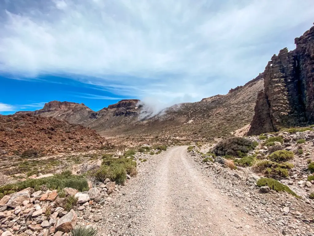
8. Siete Cañadas: Exploring the enigmatic volcanic landscape of Teide
Another of the recommended hikes in Tenerife is Siete Cañadas, part of the old Camino de Chasna that connected the north and south of the island.
This route is located in the area of the Teide National Park, in a zone where volcanic sediments have accumulated after several eruptions. Although its appearance is somewhat desert-like, it is one of the most geologically interesting areas of Tenerife. As you walk this trail, you will discover part of the enigmatic landscape of Siete Cañadas.
The itinerary starts from the National Parador, offering you privileged views of Teide right from the start.
The best time to do this route is in June, when tajinaste blooms, one of Teide’s most characteristic plants. However, at other times you can also enjoy the impressive geological formations, such as Roque del Capricho.
Duration: 4–5 hours
Distance: 16.4 km
Difficulty: Medium
When to do it: spring and autumn
Type: linear
Obstacles: in winter and summer, temperatures can be extreme
Elevation gain: 400 meters
[DOWNLOAD ROUTE]
9. Guajara Trail: Conquer Tenerife’s third peak with panoramic views
The Guajara Trail is another unmissable experience in Tenerife, as it takes you to the summit of the third highest peak on the island.
An interesting anecdote is that the mountain is named in honor of a Guanche princess who took her own life by leaping off after learning of her beloved’s death on the battlefield.
The journey to the summit offers spectacular views, especially during May and June, when the tajinaste is in full bloom, accompanied by daisies, retama, codeso, and pajonera grass. From the top, you can appreciate 360-degree panoramas that include Teide, the Roques de García, Pico Viejo, Montaña Blanca, Montaña Rajada, and other corners of Teide National Park.
Duration: 4 hours
Distance: 10 km
Difficulty: Medium
When to do it: spring and autumn
Type: circular
Obstacles: in winter and summer, temperatures can be extreme
Elevation gain: 770 meters
[DOWNLOAD ROUTE]
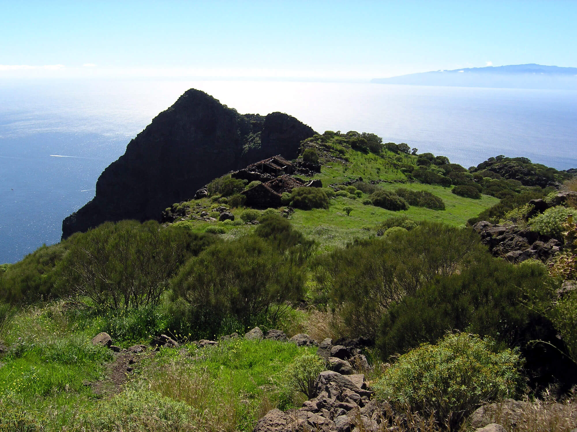
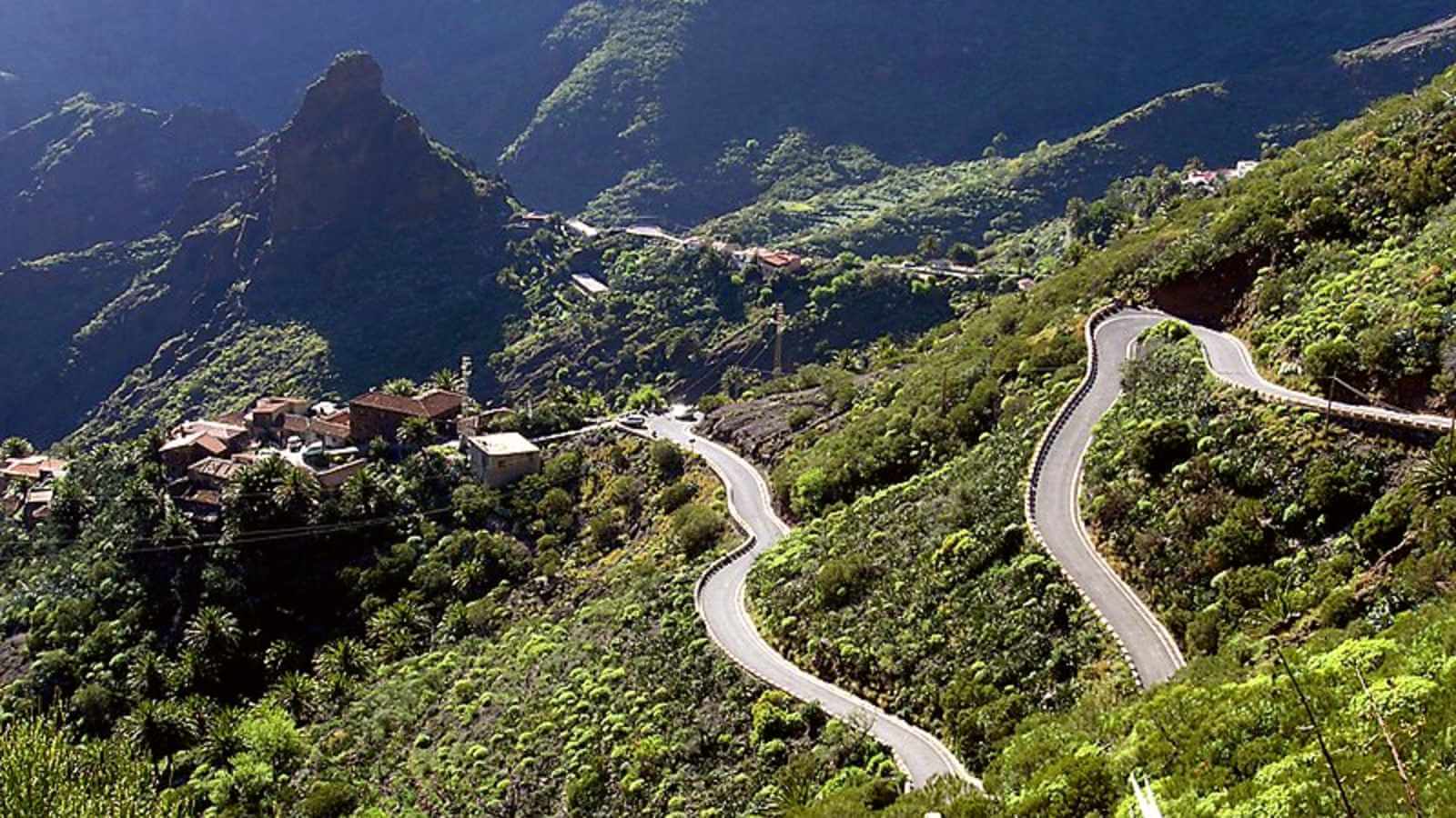
10. Teno: Wild nature among ancient forests and deep ravines
The Teno Rural Park is one of the most beautiful natural spaces in Tenerife, famous for its cliffs and laurisilva forests. If you are looking for trails in the north of the island, the Teno route is an unbeatable option.
This hike will allow you to explore a large part of the Teno Rural Park, passing through towns such as Buenavista del Norte and Los Silos.
The route begins in Las Portelas, in the El Palmar valley, from where you take a trail that ventures into a beautiful laurisilva forest, one of the great attractions of this route. It continues to the Old Pajales, allowing you to discover the Casas de la Cumbre and the Martín Bay Summits, from which you obtain marvelous views of the ancient Teno volcanic massif. In this massif, highlights include places like Masca Gorge, although you can also see others, such as Los Carrizales. If the day is clear, it is even possible to glimpse La Gomera and La Palma.
All this precedes the final stage, which leads to La Cancela and returns to Las Portelas, closing this circular route.
During the hike, you can appreciate various plant species, such as laurel, acebiño, aderno, campanillas, and pata de gallo; as well as fauna, especially birds like the rabiche pigeon and the turqué pigeon. Undoubtedly, it is the best route to get to know Teno Rural Park in depth.
Duration: 5–6 hours
Distance: 11.5 km
Difficulty: Medium
When to do it: any time of year
Type: circular
Obstacles: elevation changes
Elevation gain: 560 meters
[DOWNLOAD ROUTE]
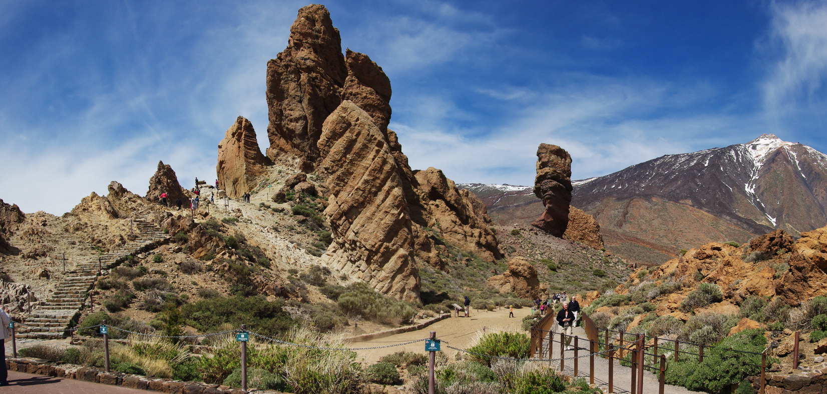
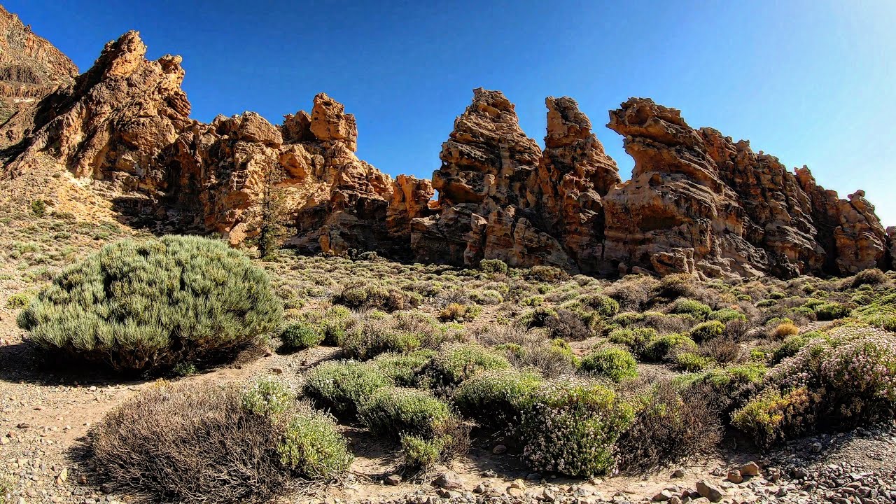
11. Roques de García: A circular route among volcanic wonders
The trail that circles the Roques de García is one of the best routes to explore Teide, as it allows you to appreciate up close these peculiar rock formations, sculpted over years of erosion from various materials.
Located in the Teide National Park, this circular route is perfect for travelers with little time who want to see the Roques de García. The journey starts at the La Ruleta viewpoint, leading you to observe notable formations such as Roque Cinchado, Torrotito, El Burro, and the Roques Blancos.
In addition to the rocks, the route allows you to discover lava flows, including the famous Cascada and a unique volcanic chimney called the Cathedral, due to its resemblance to an imposing structure. Undoubtedly, it is one of the trails in Tenerife that will help you understand the impact of volcanic activity on the island.
Depending on the season, you can also enjoy the red blooming tajinaste and other plant species.
Duration: 2 hours
Distance: 3.5 km
Difficulty: Low
When to do it: spring and autumn
Type: circular
Obstacles: extreme temperatures in winter and summer
Elevation gain: 181 meters
[DOWNLOAD ROUTE]
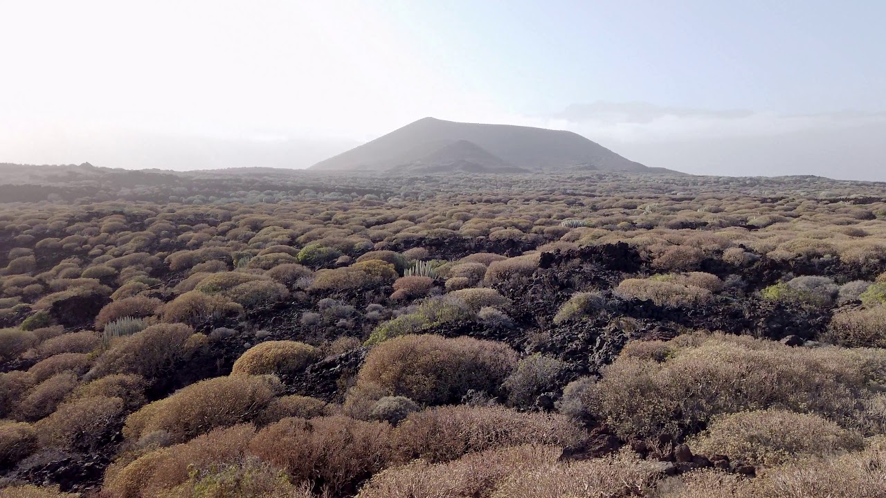
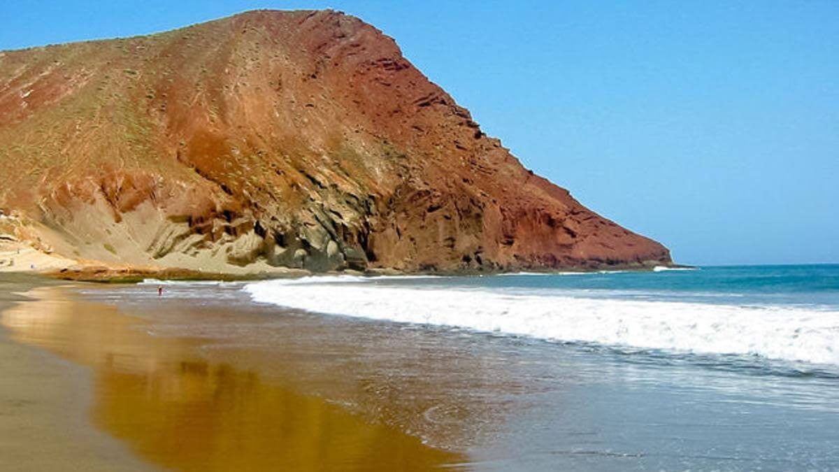
12. Güímar Badlands: An easy hike in a lunar landscape
Declared a Special Natural Reserve, the Güímar Badlands is ideal if you are looking for easy trails in the north of Tenerife. This route takes you to discover an almost extraterrestrial landscape.
The hike starts at Puertito de Güímar and ventures into the natural reserve, which has been protected since 1987. From the very beginning, the landscape will astonish you: a desert-like setting where reddish sand contrasts with the black of solidified lava, creating a spectacular scene.
Walking this route means venturing into a science-fiction landscape, discovering volcanic tubes and caves, such as Cueva Honda, and several viewpoints that offer stunning vistas. It is the best way to understand the unique geology of the area.
Despite its arid appearance, there is also vegetation, such as tabaiba or cardón, emerging from the cracks in the lava. Additionally, if you are looking for kid-friendly trails in Tenerife, this option is ideal, as it has little elevation gain and does not require extensive physical preparation.
Duration: 4 hours
Distance: 8.2 km
Difficulty: Low
When to do it: spring and autumn
Type: circular
Obstacles: extreme temperatures in winter and summer
Elevation gain: 155 meters
[DOWNLOAD ROUTE]
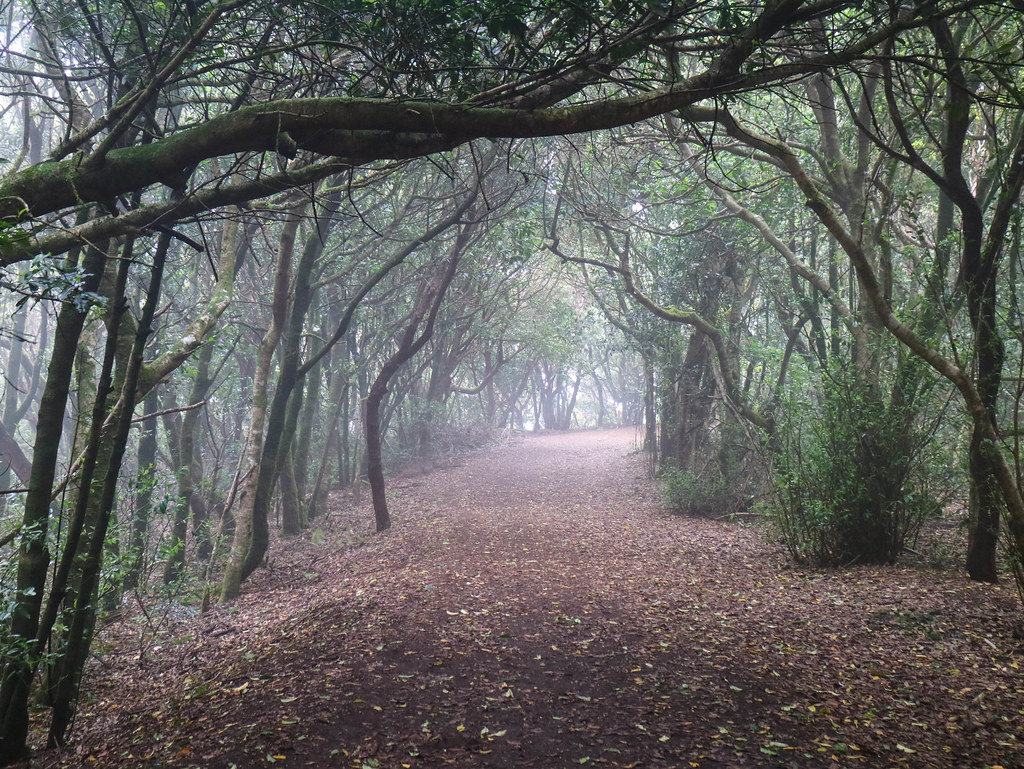
13. Centenary Guardians: A magical encounter with ancient trees in Tacoronte
The route of the Centenary Guardians stands out for its dreamlike landscapes. This trail is located in the town of Agua García, in Tacoronte, within the forest of the same name.
Its name pays homage to the imposing vine trees, which are believed to be up to 800 years old and, like true guardians, protect the local flora—among laurisilva, heathers, fayas, and lime trees—and fauna of the area.
The journey starts at the Heritage Information Center of Agua García. From there, the environment transforms into a laurisilva forest dotted with bridges, caves, and occasionally a light mist that adds a magical touch to the landscape.
Many travelers consider this route as charming as those found in the Anaga Rural Park, but with the advantage of being much quieter.
Duration: 3 hours
Distance: 5 km
Difficulty: Low
When to do it: any time of year
Type: circular
Obstacles: none
Elevation gain: 290 meters
[DOWNLOAD ROUTE]
14. Cruz del Carmen – Punta del Hidalgo: A diverse journey between laurisilva and cliffs
Many hiking trails in Tenerife are located in or around the Anaga Rural Park, such as the one that connects Cruz del Carmen and Punta del Hidalgo, one of the most impressive viewpoints on the island.
This hike starts at the Cruz del Carmen restaurant and from there descends towards Las Carboneras. It then continues to Chimanada before finally reaching Punta del Hidalgo.
The journey is divided into three sections: in the first, the characteristic laurisilva forest of the Canary Islands stands out; in the second, the landscape becomes more agricultural; and in the third, you descend through scrubland that culminates on the rugged northern coast of Tenerife. It is one of the ideal routes for those who wish to enjoy a variety of landscapes in one itinerary.
Duration: 4 hours
Distance: 11 km
Difficulty: Medium
When to do it: any time of year
Type: linear
Obstacles: sections with steep descents and stone paths, which can cause slips
Elevation gain: 600 meters
[DOWNLOAD ROUTE]
15. Ascent to Montaña Roja: Accessible route with stunning views of the south
If you are passionate about the mountains, climbing Montaña Roja is an excellent option among the recommended hikes in the south of Tenerife.
Declared a Special Natural Reserve, Montaña Roja protects endemic species of both flora and fauna, especially birds, and preserves geological elements of great value.
Unlike other mountain trails, this route is easier and does not demand excessive physical effort. Travelers can start from El Médano, La Tejita Beach, or from the parking lot located between El Médano and Los Abrigos, which connects with the trail to the summit. Any of these starting points allows you to enjoy the views equally, as from the summit you can appreciate panoramas of La Tejita Beach, El Confital Beach, and the picturesque town of Los Abrigos, in addition to a unique volcanic setting.
Undoubtedly, it is one of the most pleasant hikes in the south of Tenerife, notable for its natural beauty as well as the diversity of flora, fauna, and geology it offers.
Duration: 2–3 hours
Distance: 4.5 km
Difficulty: Low
When to do it: spring and autumn
Type: circular
Obstacles: extreme temperatures in winter and summer
Elevation gain: 160 meters
[DOWNLOAD ROUTE]
Interactive map of the hiking trails in Tenerife
Below, we provide you with a map of the hiking trails in Tenerife so you can better plan your trip and decide which routes you want to take.
We recommend taking this map with you, as it will help you locate the starting point and the main points of interest on each route.
If you have any questions, feel free to leave a comment below and I will gladly help you in any way I can.
Enjoy hiking in Tenerife!

